Wednesday 16 December 2009

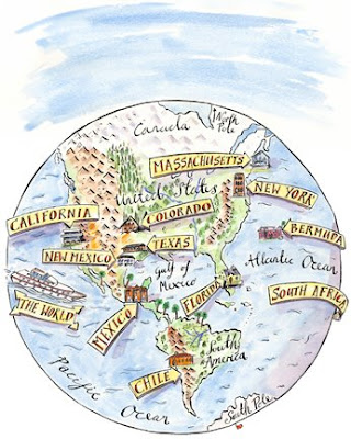
52 weekends by the Sea-52 maps of the seaside


52 Weekends by the Sea published by Virgin Books spring 2010
Feel the tingle of salty breezes on your skin and the drama of wide horizons where seabirds fly. From the romance of sunset picnics in a Welsh landscape to the thrill of wild camping on a remote Scottish beach, from the flavors of the freshest seafood in Seahouses to the luxury of a hideaway hotel in Crinan, writer Brigid Benson, photographer Craig Easton and maps by Maps Illustrated have created 52 weekends that will inspire you. Share their secrets to create your own adventures and meet intriguing people in surprising places along the way. 52 Weekends - where will you be going?

Tuesday 15 December 2009

Property Development Map


Maybe things in the property market are picking up a little at the moment (hopefully it will continue) as I was commissioned last week to produce a map to go with a property development in Wimbledon,London. The property developers, Harepath Developments have developed a commercial site at 7 Elm Grove, Wimbledon which is being let as office space. Hopefully clients will be able to find the location with my map.

Monday 30 November 2009

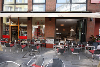
Map Illustrated cafe art mapping Cologne


A while back I was asked by a Restranteur in Koln to supply some images that they could put on the walls. The Cafe/Bar was to have a Parisian feel to it and the images where to follow this theme. After some discussion we decided not to go for paintings but to actually produce 'wallpaper' designs that could be a permanent part of the design and not just look like an after thought. The Cafe is now part of the Koln scene and gets some good write ups in the local and national press. When in Koln do as the Kolnians??? do and visit the Cafe Flaneur, Friesenwall 24d, 50672 Köln, Germany

Passport magazine says"If you prefer sipping your coffee with a gayer crowd, the area around Rudolfplatz has much to offer. Right across the street from each other, Café Era and Café Flaneur are the lynchpins of the neighborhood’s gay caffeination. In summer both spots feature tables on the sidewalk, while wintertime points up their differences, from the deeply-hued and modern/stark look of Era to the French-themed Flaneur with its map of Paris scrawled across the wall. More coffee? More sweets? "

Thursday 17 September 2009

Walking London

I am just starting to illustrate a series of walks around central London for a publisher based in Andover. The only problem is that I really want to go and do the walks and spend 15 days just getting to know extra bits of London, although to be fair I do know about 70% of the places but still it is great fun finding out more about your own city. I am really looking forward to getting my pencil and inks into this job and feel very positive about how it will all work out. As soon as I am able I will post some images for you to see.

Tuesday 30 June 2009

D-Magazine Dallas Again


Another illustrated map for D-Magazine in Dallas.

Wednesday 24 June 2009

walking maps, more walking maps and trekking map


Is it just me or is everyone walking this summer? I started the year with a series of walking routes to school maps for national walk to school week ( which Maddie Bee got a certificate for walking the 2nd most miles to her school-luckily you could include the train journey as walking), last week i completed a series of British walking route maps for the fine purveyors of women's fitness - ZEST magazine and this week I have been asked to work on a fab book of London walks which I am very excited about. While taking things to another level i am also do a Trekking map of a region in Northern India for The Wall Street Journal. Well I am off to get my boots now and do ten laps of my studio.

Friday 15 May 2009

George W Bush's Map of Dallas


So a few weeks ago we produced this map for D magazine in Dallas of George Bush's new neighbourhood in North Dallas and noted a few of his not so famous ( as W ) neighbours.
I think the maps went down well and hopefully it gets a good response in Dallas Texas for the work of Mapsillustrated.com

Wednesday 22 April 2009

Safe Walking Route to school maps


I have recently been commissioned to produce a set of maps to show safe walking routes to a school in Aldgate, London. This should turn out to be a lovely project for me and an interesting piece of information for the pupils. Not only has it allowed me to revisit a part of London I have not seen for a while it also gave me chance to look at the Gerkin Building at close range and see some of the new development sites around the Aldgate Union.
The visuals/rough sketches that I produced on the walk I am submitting to the handmap.org. For publication in a new book of maps to be published by the Princeton Press

Friday 20 March 2009

The Best of 2008-Illustrated Maps

I have put together a PDF of some of our best illustrations of 2008 which can be downloaded from our website at I will try and put it on here also but not sure if it will work. Take a look and I look forward to your comments. http://www.mapsillustrated.com/_pdf/best_of_2008.pdf

Monday 16 March 2009

In The beginning God created The World


In the beginning of this blog we created the world!